Helping Texas Ranchers and Wildlife, One Plan at a Time
NEWS: NRCS Range Management Specialist Clint Rollins works one-on-one with agricultural producers in the Texas Panhandle to develop conservation plans that benefit wildlife and ranch operations. Read about it! >

$8 Million Fund Created to Improve Water Quality and Conserve Greater Sage-Grouse in the Eastern Sierra
January 20, 2017
Conifer Removal Boosts Sage Grouse Success
January 26, 2017By Quenna Terry, NRCS Public Affairs Specialist
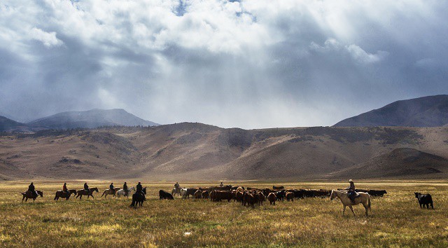
In the Panhandle of Texas, three things are certain: cattle will graze the grassy prairies, the wind will turn windmills on the plains, and Clint Rollins can be found helping ranchers improve wildlife habitat on their land.
Rollins is a range management specialist in Amarillo for the USDA Natural Resources Conservation Service (NRCS). His 38 years of knowledge have helped fuel the success of Texas NRCS in engaging ranchers to voluntarily carry out habitat conservation practices that benefit the lesser prairie-chicken, with technical and financial assistance from the NRCS-led Lesser Prairie-Chicken Initiative (LPCI).
Lesser prairie-chickens once inhabited some 180,000 square miles of the southern Great Plains, in Colorado, Kansas, Oklahoma, New Mexico and Texas. They now occupy about 17% of that original range. In Texas, they’re found in northeastern and southwestern areas of the Panhandle region.
Rollins took the lead in conservation planning efforts in the northeastern Panhandle—particularly Lipscomb, Hemphill, Hansford, Ochiltree, and Gray counties—helping ranchers plan and adopt conservation practices most beneficial to wildlife habitat, while ensuring compatibility with livestock grazing.
Stan Bradbury, NRCS zone range management specialist said, “Rollins has spent years developing relationships with agricultural producers in the Panhandle region. It’s this kind of trust- and relationship-building that has allowed Rollins and other employees to work with these ranchers and conduct field work, data entry, and mapping.”
Guiding the Conservation Planning Process
LPCI is one of several landscape-level conservation initiatives within the Working Lands for Wildlife (WLFW) program, which works to restore at-risk wildlife species on private working lands, while providing landowners with regulatory predictability. Part of that process is developing a predictability plan.
“‘Predictability plan’ is a fancy word for a conservation plan,” Rollins said. “It’s a road map for a producer’s land management goals.” Predictability plans have the added benefit of providing regulatory certainty to participating landowners.
To develop a conservation plan, Rollins measures and assesses forage production, plant communities, plant composition and brush canopy transacts. “Our plant transects start with identification of Prickly pear, Yucca, [shinnery] oak, and other species to determine the grazeable acres,” Rollins said.
Using state-of-the-art mapping tools, Rollins first creates a map that identifies grazing and non-grazing areas. “On an annual basis we want to know the forage demand with forage supply,” Rollins said. “If we didn’t have the technology we have today, it would take ten times as long to do conservation plans of this magnitude,” he said.
Rollins then recommends conservation practices that meet the needs of lesser prairie-chickens and the management goals of the participating landowner. These recommendations include such core practices as prescribed grazing and brush management.
Other practices can include prescribed fire, water development to better distribute grazing, weed control, wildlife-friendly structures such as ramps in water tanks, cover crops, and more.
“The most important practice is prescribed grazing to balance forage supply,” Rollins said.
From 2012 to 2015, Rollins helped seven ranchers on more than 40,000 acres. “I’ve worked with good stewards of the land who are livestock producers,” he said. “The people I’ve worked with trust me, and they live on the land that I’ve worked on.”
Rollins has found that when most ranchers learn more about the resources they have on their land, they are eager to improve them to benefit both their ranching operation and the various wildlife species that make their home on their land.
Drought contingency planning is a key part of the conservation planning process, identifying management actions to take if drought conditions occur. Quick, carefully planned response to drought can reduce both financial and habitat impacts.
In 2012, following of one of the worst droughts in recent history, ranchers in the Panhandle region were panicked. Clay loam soils that produced 3,500-4,000 pounds of forage per acre in wetter years produced just 1,000-1,200 pounds in 2012.
 “I had to help calm the ranchers down,” Rollins said. “My job was to convince them to take a vacation and come back later.” Wet weather following the drought improved grazing distribution.
According to Rollins, the land needed time to heal itself. From 2012 through 2015 the grass cover made a comeback, and the ranchers could see a difference through the recovery options NRCS had to offer them.
In 2015 and 2016, through the efforts of Rollins and his colleagues in the Panhandle Region, the NRCS and Texas State Soil and Water Conservation Board, working through the Soil and Water Conservation Districts, provided conservation planning assistance to 27 private agricultural producers.
Their work resulted in conservation plans for 186,000 acres of grassland habitat through LPCI and WLFW technical assistance programs, with an additional 40,000 acres nearing completion. In the coming year, predictability planning in the Panhandle region is estimated to exceed 200,000 acres.


