Map Layer Identifies Risk of Converting Sagebrush to Cropland
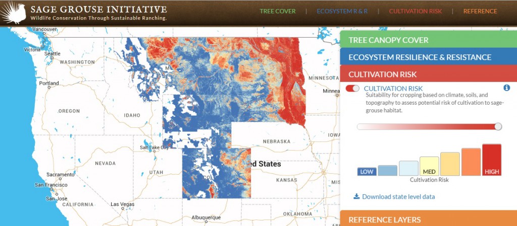
Today, the Sage Grouse Initiative is unveiling a new layer on our interactive web application that shows where the risk of cropland conversion is highest. The new “cultivation risk map” layer predicts where future sagebrush habitat loss could occur based on soils, climate, and topography of existing croplands.
Plans To Save Bi-State Sage Grouse in Nevada Gain Momentum
April 12, 2016
Conservation Integral At O’Tooles’ Ladder Ranch in Wyoming
April 19, 2016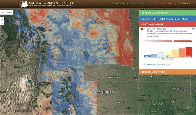
Mapping the threat of potential crop cultivation helps put conservation easements where sage grouse need them most
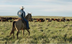
SGI helps landowners put in place rangeland practices that conserve the sagebrush sea. Photo by Linda Poole.
One of the greatest threats to sage grouse that live east of the Rocky Mountains is the conversion of the sagebrush sea into fields of crops. As commodity prices climb, more farmers and ranchers are tempted to cultivate native grasslands into rows of wheat or corn, particularly in Montana and the Dakotas.
But once the sage-steppe is tilled up for crop production, it’s next to impossible to turn it back into the diverse habitat birds and other wildlife need to survive.
Today, the Sage Grouse Initiative is unveiling a new layer on our interactive web application that shows where the risk of cropland conversion is highest. This web app, which launched in February to bolster conservation efforts across the range, also provides information on ecosystem resilience and resistance, tree canopy cover, and sage grouse conservation priority areas. The new cultivation risk map layer predicts where future breakout of new cultivation could occur based on soils, climate, and topography of existing croplands.
This model was developed by Jeffrey Evans, a landscape ecologist with The Nature Conservancy and affiliate faculty at University of Wyoming, who used a variety of data sets to map the probability of cropland cultivation. The layer on SGI’s web app shows the risk in Montana, North Dakota, South Dakota, Colorado and Wyoming, including modeling at the county level. The data for each state is available for download for free.
“This is a targeting tool,” says Evans. “It allows partners to prioritize conservation easements to get the best bang for the buck.”
Evans’ goal in creating this model was to flush out the cultivation risk in key sage grouse habitat in order to allow funders—like the Natural Resources Conservation Service or The Nature Conservancy—to make more informed decisions on where to focus land protection programs.
“The model helps balance land-use patterns. We can optimize where crops are developed while also protecting intact, native landscapes for wildlife,” explains Evans.
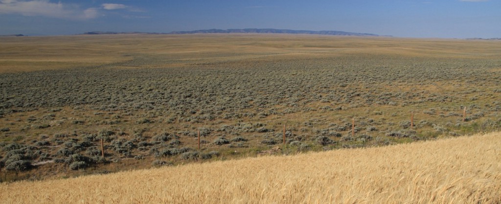
Cultivation for wheat production like the field in the foreground impacts ranching and sage grouse. Photo by Conservation Media.
Once native sage-steppe is converted, it’s very difficult and very costly to restore habitat. That’s why it’s critical to identify the areas most at risk and overlay that data with the birds’ strongholds. This allows SGI and our partners to proactively provide incentives that encourage agricultural producers to conserve prime habitat for sage grouse.
In a recent SGI Science to Solutions report, Evans and Joe Smith—a PhD student at the University of Montana—found that 96% of active sage grouse leks are located in landscapes with less than 15% cropland. For each ten percentage point increase in cropland, these scientists anticipate an associated 54% decrease in lek density.
“Particularly striking to me is that one landowner converting a single square mile into new cropland negatively impacts sage grouse in a landscape twelve times that size,” says Smith.
Smith explains that successful conservation planning requires mixing three ingredients: biological value, risk, and cost. Both bird abundance (biological value) and the risk of crop cultivation are highly variable across the West, meaning targeting conservation programs can be tricky without the right data.
“We need to be able to map all three of those variables across the landscape to know where conservation dollars are best spent,” says Smith. “This cultivation risk map provides the third leg of the stool to get the best return on investment in easements.”
SGI works with ranchers to put in place conservation easements using Farm Bill funds through the NRCS. Conservation easements allow ranchers to continue to graze cattle sustainably on their property in perpetuity, while restricting various forms of development and preventing future cultivation in these sensitive areas.
Our partner in the prairie region, the Lesser Prairie Chicken Initiative, is also using Evans’ cultivation risk model to assess the probability of cropland conversion across the historic range of lesser prairie-chickens in parts of Colorado, Kansas, New Mexico, Texas, and Oklahoma.
Stay tuned for an upcoming scientific study authored by Smith, Evans and others that validates the cultivation risk model and describes how to reduce the threat of converting sage-steppe habitat into crops. The new research paper is slated for publication this summer in Biological Conservation.
Check out SGI’s interactive map and web app
Read SGI’s Science to Solutions Report, “Reducing Cultivation Of Grazing Lands Conserves Sage Grouse“

