Data-Driven Wildfire Recovery in the Great Plains
New wildfire recovery website translates decades of rangeland and fire ecology research into a decision-support resource for Nebraskans.

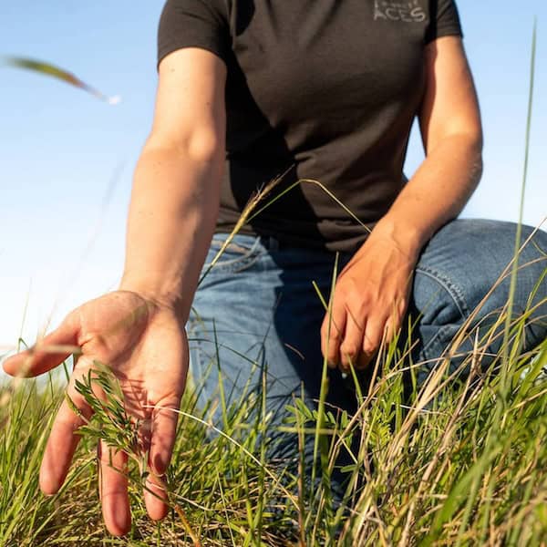
What Are Mesic Resources?
April 28, 2026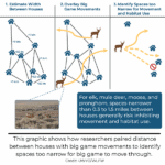
Where There’s Width, There’s A Way (For Big Game To Move)
May 20, 2026
Worst Wildfire in Nebraska’s History Raises Questions About Rangeland Recovery
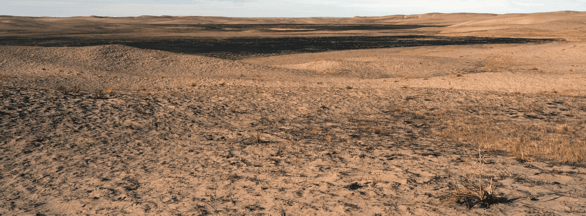
Spring is typically a time of growth, renewal, and regeneration. In parts of Nebraska, however, the spring of 2026 was different. On March 12th, the Morrill Fire began its destructive, 13-day march across the state. The Morrill fire burned more than 640,000 acres in the Nebraska Sandhills, making it the largest single fire in the state’s history. Three other large wildfires also swept across Nebraska this spring: the Cottonwood Fire (128,000 acres), the Road 203 Fire (35,912 acres), and the Anderson Bridge Fire (17,400 acres).
In a matter of days, this series of large wildfires burned more than 842,000 acres of Nebraska. The events raised urgent questions about vegetation recovery, forage production, and long-term resilience of working lands post-fire.
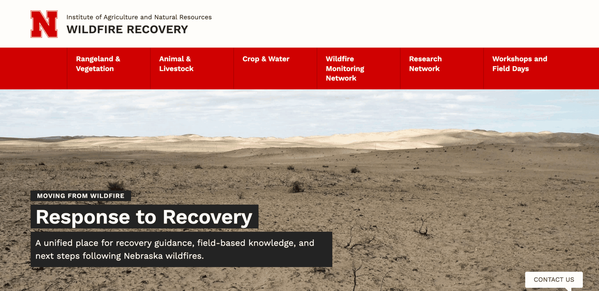
A new interactive website developed by Working Lands for Wildlife and the University of Nebraska-Lincoln uses maps and graphs to help landowners and resource managers better understand and respond to wildfires in the Great Plains. Read the Q+A below with Dirac Twidwell to learn more.
What is the wildfire recovery site?
The website translates decades of rangeland and fire ecology research into a decision-support resource that can be applied in real time following wildfire. At its core is the Rangeland Analysis Platform (RAP), a satellite-based system that quantifies vegetation dynamics across the Great Plains. RAP allows users to evaluate post-fire recovery trajectories, compare current events with historical fires, and interpret vegetation responses within a broader ecological context.
The platform extends beyond visualization by integrating Nebraska-based research into applied guidance for rangeland, livestock, crop, and water systems. This approach connects observed vegetation responses directly to management decisions. The site also facilitates access to Extension expertise and regional networks, enabling users to pair remotely sensed data with local knowledge and technical support.
What do you hope people will gain from the site?
Our primary goal is to reduce uncertainty for those impacted by wildfire. Great Plains grassland ecosystems — including the Nebraska Sandhills — have a long history of fire. They are built to recover across a broad range of fire and climatic conditions. Science can reduce uncertainty for people worried about whether recovery will occur. Hopefully, this resource can lessen the burden and the myriad stressors facing individuals impacted by wildfire events.
These fires burned more than 800,000 acres. Is that a lot?
It’s a large footprint, especially by modern standards. But from an ecological standpoint, fire at that scale is not outside the historical range of variability for fire in grasslands. What distinguished these events was the rate of spread, driven by extreme wind conditions exceeding 70 mph and low fuel moistures. This allowed the rapid expansion beyond 500,000 acres. Only a couple other fires in the Great Plains have exhibited comparable rates of spread and total area burned.
Can you describe the 4 sections of the fire recovery site?
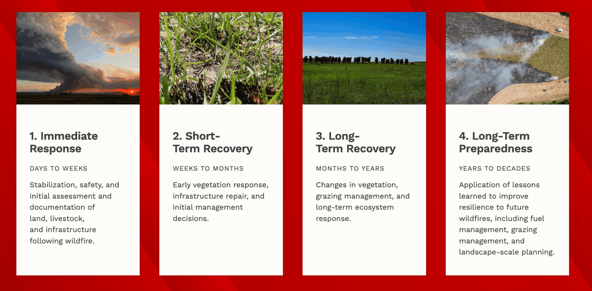
The sections reflect the temporal progression of both ecological recovery and management decision-making. Immediate post-fire needs, such as livestock management and infrastructure assessment, differ substantially from short- and long-term considerations related to vegetation recovery and system resilience.
Organizing the site in this way allows us to align scientific information and technical guidance with the appropriate phase of recovery. It also reduces the burden for individuals having to search for the right information at the right time.
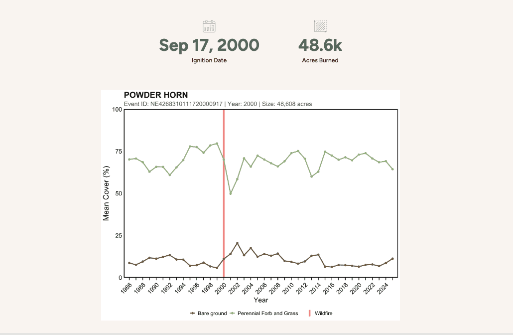
What can we learn from the site’s interactive maps and graphs about the impacts of recent wildfires?
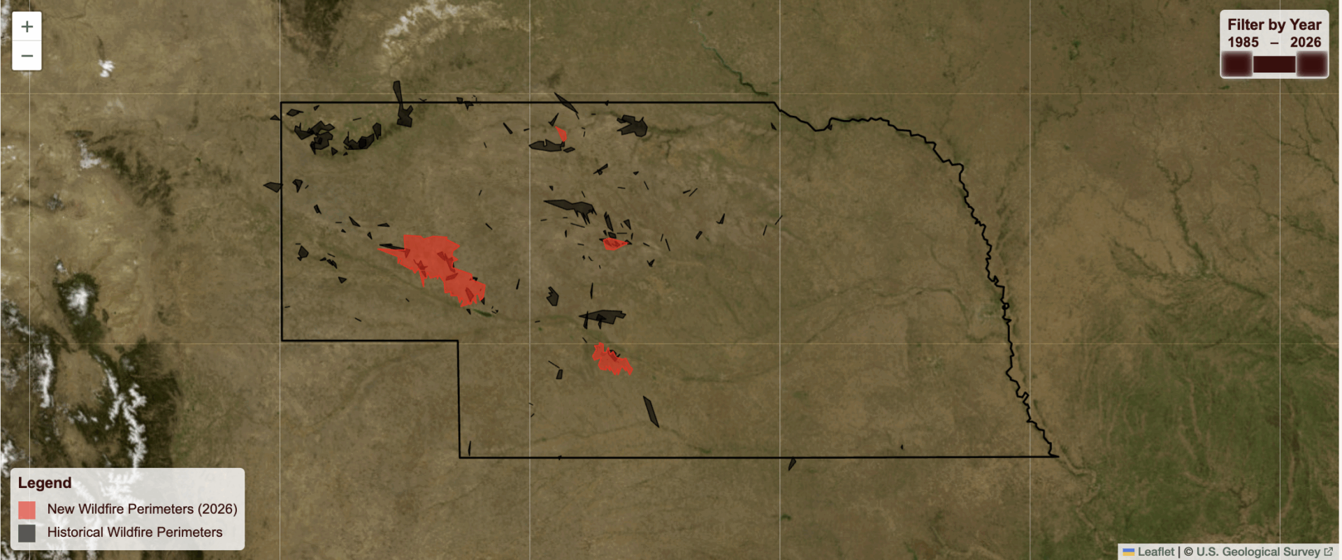
The hope is to connect people. An important goal was to leverage technology as a mechanism for connecting individual experiences to broader patterns. Knowing that other producers and nearby ranchers have also experienced wildfires allows people to share experiences, learn what to expect, and advance our ability to support each other and our communities.
Users can self-explore past wildfires. This allows anyone to compare current conditions with analogous past fires and evaluate how factors such as weather, soils, and prior management influence recovery trajectories. The data visualizations demonstrate a more consistent trajectory of vegetation response than many might expect following wildfire in Great Plains grasslands.
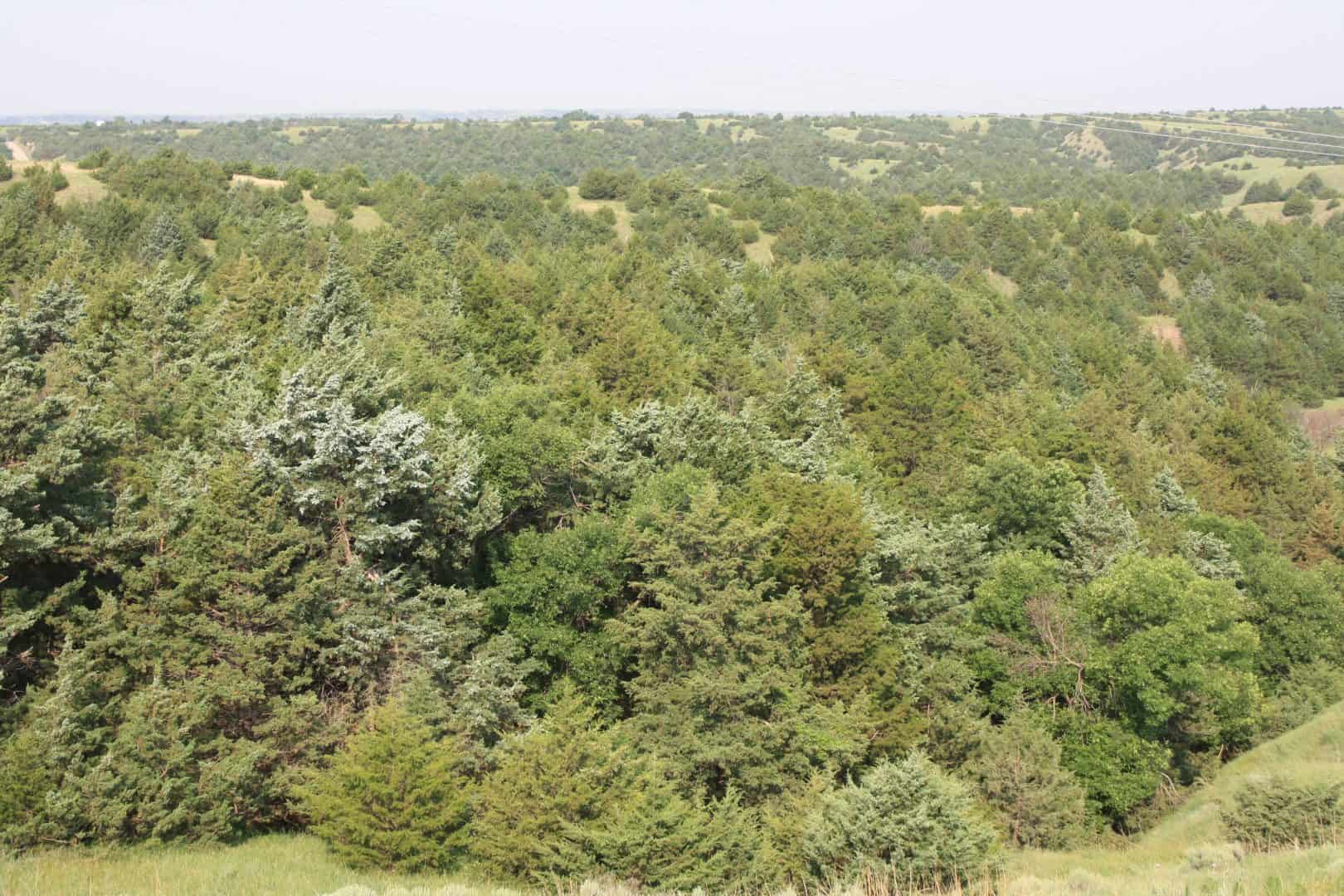
How does woody encroachment fuel wildfire risk in the Great Plains?
As eastern redcedar encroaches into grasslands, it creates more volatile fuel for wildfires in the Great Plains. Woody encroachment has been identified as a primary driver of increased fire risk in the region.
The expansion of eastern redcedar supports higher-intensity fire behavior, heightened rates of spread, increased flame lengths, and longer ember transport distances. As these trees expand into grasslands, they increase fuel loads and create continuous vertical and horizontal fuel structure. This allows fire to transition beyond surface behavior typical of grasslands. It also increases pressure on wildland fire suppression resources.
Can conservation practices help reduce wildfire risk?
Working Lands for Wildlife and NRCS focus on preventing eastern redcedar expansion and restoring grass-dominated systems at scale. Practices like shrub removal and prescribed fire reduce the number of trees. This, in turn, lowers the amount of volatile fuels in the Great Plains.
Removing woody species like eastern redcedar helps moderate fire behavior and maintain conditions more consistent with historical grassland fire regimes. In this way, the conservation actions used to support wildlife habitat for a suite of grassland species are also contributing to the reduction of wildfire risk on working lands.