Photo: Martin Townsend
Keeping Grasslands Green Side Up
Continued conversion of native grasslands to crops is one of the largest threats facing grasslands in the Great Plains.
This map depicts the probability of cultivation relative to climate, temperature, soils, and topography. It can be used to identify intact grasslands and where there is potential to maintain and expand grasslands in landscape cores with low cultivation risk.

Monthly CRP summary data are available, including county-level maps depicting CRP enrollment and expiration across the U.S. The products can be used to inform targeting efforts to transition CRP to grazing lands.
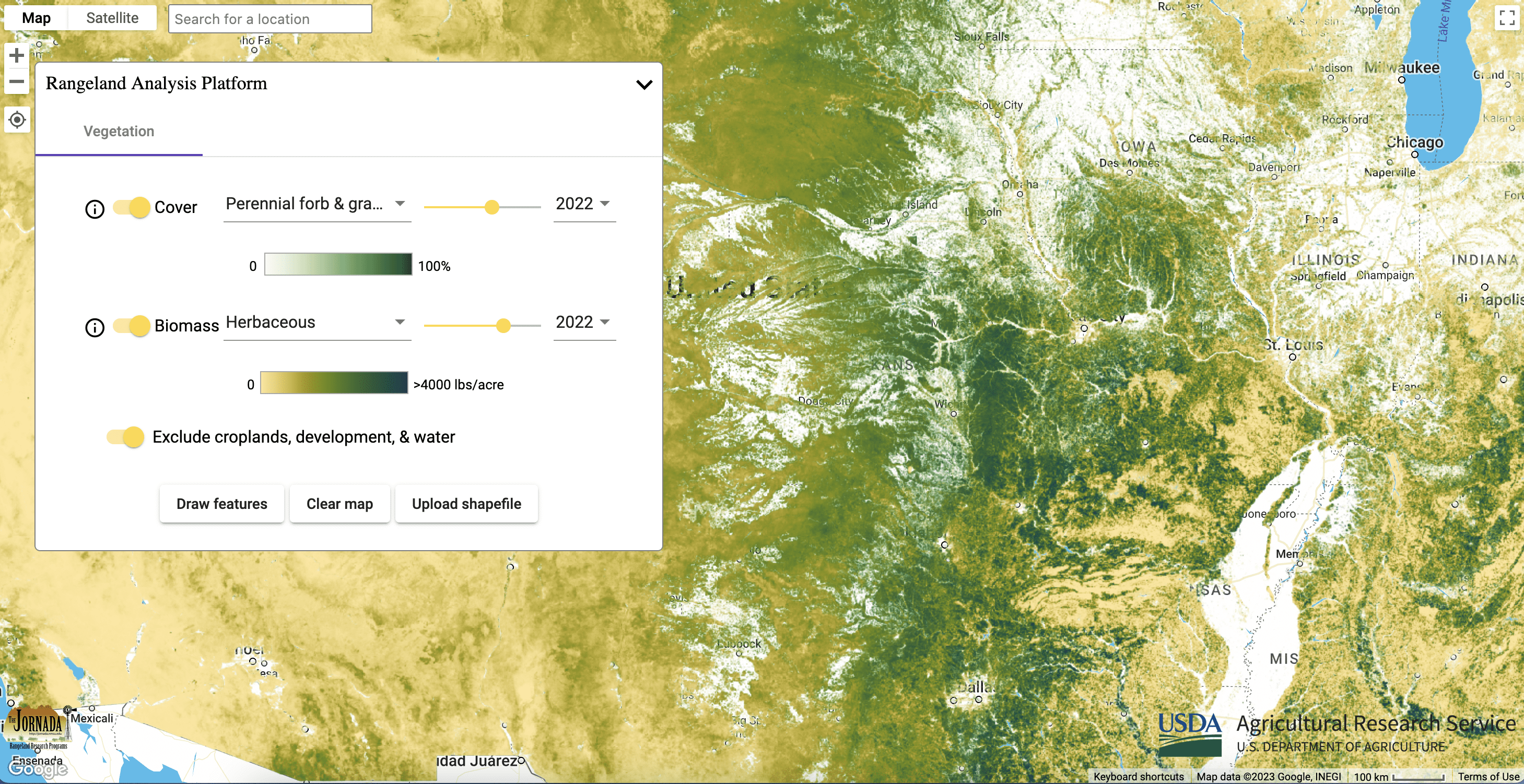
These maps provide annual percent cover estimates from 1984 to present of: annual forbs and grasses, perennial forbs and grasses, shrubs, trees, and bare ground. The data can be used to identify relatively unfragmented grassland cores and monitor the efficacy of conservation actions at preventing land use conversion.

These maps provide annual and 16-day aboveground biomass from 1986 to present of: annual forbs and grasses, perennial forbs and grasses, and herbaceous (combination of annual and perennial forbs and grasses). Estimates represent accumulated new biomass throughout the year or 16-day period and do not include biomass accumulation in previous years. The data can be used to quantify rangeland productivity protected, enhanced, or restored.


-
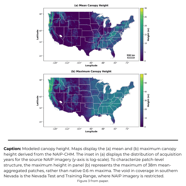
America’s Tree Canopy, Now in 3D
Mapping application models height of trees and shrubs across the entire Lower 48 at sub-meter resolution.