Ask an Expert: Early Warning Signals and Grassland Bird Richness
Caleb Roberts discusses two recent papers that highlight how the Rangeland Analysis Platform is informing on-the-ground conservation in the Great Plains.

Spatial Technology Reveals Early Warning Signs of Large-Scale Woody Encroachment Threat to Greater Prairie-Chickens
December 28, 2021
Publication Alert: Large-scale fire management restores grassland bird richness
January 18, 2022
Greater prairie-chickens depend on tree-free grasslands. New science provides early warnings of where grasslands are starting to transition to woodlands, which helps prioritize proactive restoration that protects grasslands from woody species encroachment.
The iconic imagery of the Great Plains evokes sweeping expanses of treeless grasslands stretching from horizon to horizon. While some parts of the Great Plains still look this way, millions of acres no longer do. Instead, woody plants like eastern redcedar and mesquite have replaced swaying prairie grasses, negatively impacting wildlife species and ranchers alike. New research illustrates how spatial technology can help turn the tide against woody encroachment and how wildlife positively responds to these efforts.
Woody encroachment is a substantial driver of grassland loss throughout the Great Plains, jeopardizing wildlife populations, native ecosystems, and rural and urban communities. When woody plants move in, grassland-dependent birds like songbirds and lesser and greater prairie-chickens move out or die; water supplies are reduced; vegetation diversity decreases; and forage for livestock no longer grows as abundantly.

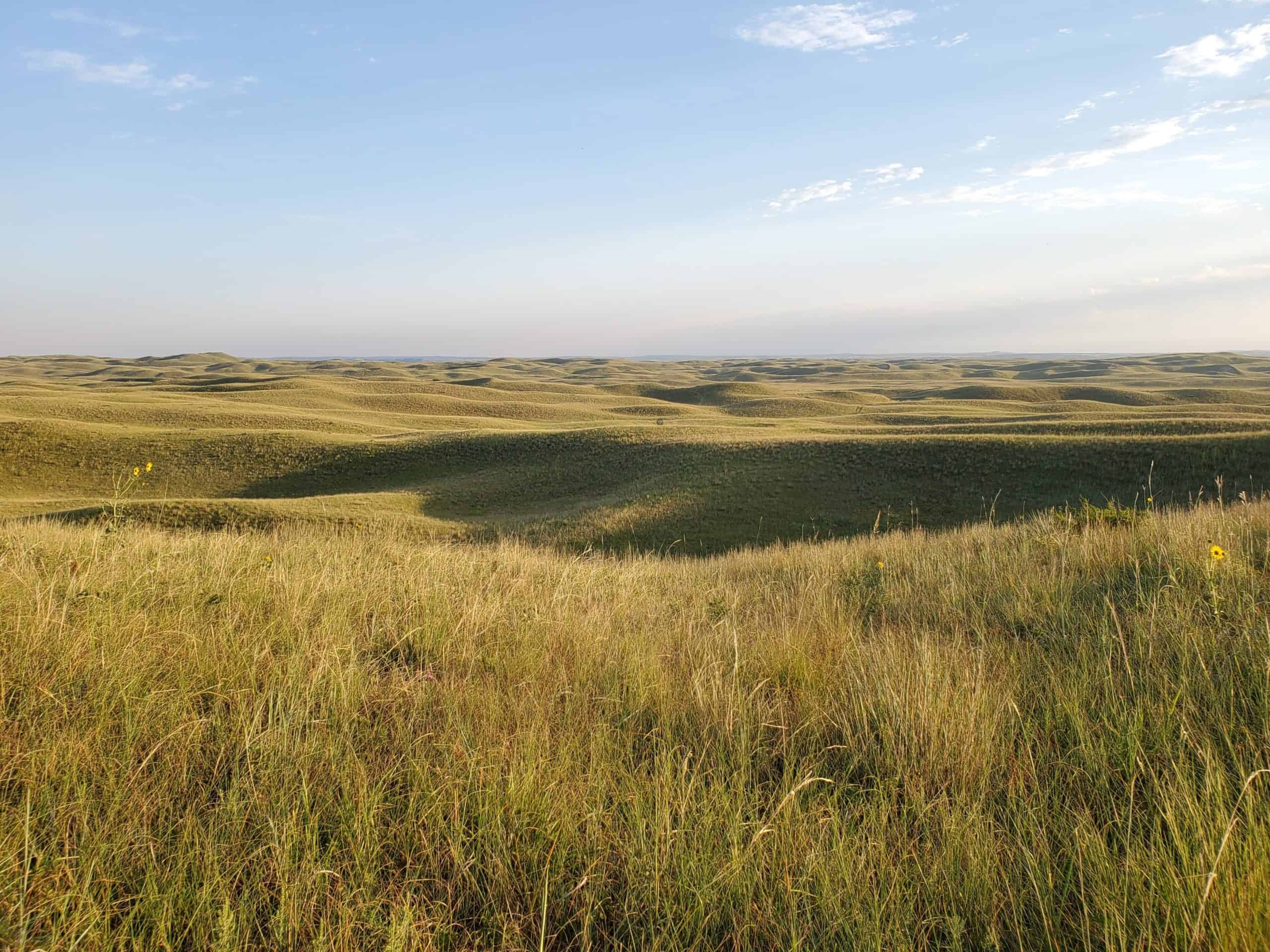
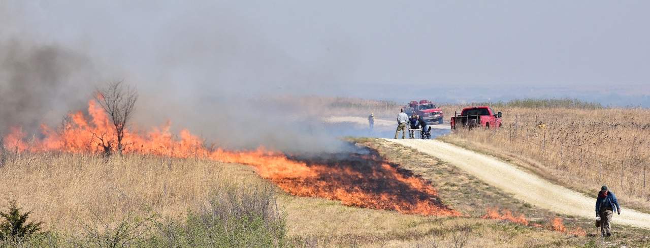
This is what Nebraska’s Loess Canyons, and the rest of the Great Plains, should look like. Prescribed fire is one of the best tools for maintaining native grasslands free from encroaching woody species. Doing so helps Nebraska’s Loess Canyons and the rest of the Great Plains look like this Photo: Dillon Fogarty.
Fortunately, new technologies are helping scientists, land managers, and producers strategically tackle this challenge and monitor how effective their efforts are for wildlife and grassland ecosystems.
Caleb Roberts, lead author of the papers, conducted his research while at the University of Nebraska. He is now a research ecologist for the United States Geological Survey (USGS) at the Arkansas Cooperative Fish & Wildlife Research Unit. Roberts’ research highlights how the Rangeland Analysis Platform (RAP) not only informs on-the-ground conservation but also demonstrates how this work benefits wildlife in two new WLFW-supported papers.
Roberts’ first paper, “Tracking spatial regimes as an early warning for a species of conservation concern” (Ecological Applications, Nov. 2021) demonstrates the utility of new maps showing early warning signals of woody encroachment in grasslands. Derived from advancements in resilience theory, these maps give warning signals of where grassland ecosystems are starting to transition to woody-dominated ecosystems – well before traditional monitoring would reveal a resource concern for land managers. With this information, managers can target conservation investments where they will benefit prairie-chickens and prevent population losses that occur if actions wait until traditional monitoring alerts managers to a woody encroachment problem.
This research focuses on Fort Riley, a five-square-mile Army base in the Flint Hills of Kansas. In addition to the Army’s First Infantry Division, Fort Riley hosts a population of greater prairie-chickens, which, like other grassland-obligate species, thrive in treeless grasslands. This new information, when combined with a new science strategy for addressing woody encroachment, can be used to safeguard critical lek locations that become abandoned when pressured by woody expansion.

Historic Fort Riley, long before encroaching woody species began moving into native grasslands. Photo from Fort Riley website.
Roberts’ second paper, “Large-scale fire management restores grassland bird richness on private lands” centers on Nebraska’s Loess Canyons region, where landowners have re-built a culture of fire over the last two decades by using prescribed fire to halt the transition of grasslands to eastern redcedar woodlands.
Roberts’ research combined 14 years of fire treatment data, six years of grassland bird monitoring data, and remotely sensed tree cover data from the RAP to observe how grassland birds responded to landscapes restored by prescribed burning across more than 330,000 acres of privately owned grasslands. His findings show a rare outcome: an increase in the number of grassland bird species across 65 percent of the Loess Canyons region treated by fire.
In this Ask an Expert, Roberts discusses these two papers and how the RAP helps produce practical, outcome-based science.
An Army base seems like an interesting place to study bird conservation. Why did you conduct your study at Fort Riley?
We did the study at Fort Riley for two reasons. First, we were being funded by the Department of Defense (DoD) to develop methods to rapidly monitor ecological change on their bases and especially to detect early warnings of ecological regime shifts. For Fort Riley specifically, the DoD wants to keep it a grassland because grasslands are critical for their infantry training.
Second, Fort Riley is a great place to test our early warning detection methods. This is because much of the base is a large, remnant tallgrass prairie. Many grassland species like greater prairie-chickens persist there, but like much of Great Plains, Fort Riley is also experiencing woody encroachment. So all the ingredients were there.
Will you explain what you mean by “regime shift” and “state transition”? Why are they so catastrophic for wildlife?
The terms ‘regime shift’ and ‘state transition’ refer to the same thing: when one ecosystem changes into a completely different ecosystem. For example, woody encroachment causes grasslands to experience a ‘regime shift’ and change into a woodland. Or cheatgrass invasion can lead to sagebrush steppe becoming an annual grassland. These changes are often very difficult and costly to reverse—especially at the scale of states or entire regions like the Great Plains. This means species that require a particular ecosystem, like how greater prairie-chickens need grasslands and can’t tolerate even a few trees per acre, cannot survive after a regime shift.
Your research focuses on the boundaries between grassland- and woodland-dominated areas. Why are these boundaries so important to study?
Okay, imagine a clean piece of paper, and then imagine spilling a bit of water with dye on it. You will see the dye staining the clean paper: that is, the boundary between the dyed paper and the clean paper will move outward and across the paper. And if you know where the boundary between dyed paper and clean paper is early on, you have a good chance of knowing where it will be in a few seconds or even minutes.
This is a lot like how regime shifts work across large swathes of land. In terms of grasslands experiencing wood encroachment, the woody plants are like the stain, and the grasslands are like the clean paper. Without something like fire to regularly remove woody plant seedlings, woodlands spread outward from these boundaries, invade grasslands, and literally push out grassland species like greater prairie-chickens.
So in summary, during a regime shift, the boundaries are where the ‘action’ happens, and if we can quickly find and track boundaries, we can predict where and when regime shifts will happen in the future.
What did you find?
We found greater prairie-chicken leks simply did not occur anywhere near boundaries between grasslands and woodlands. The amount of area leks could and did occupy visibly shrank across Fort Riley. If you look at the maps in our paper, it looks like a noose is tightening around the grasslands. And this didn’t take centuries. It happened in about 25 years.
But critically, tracking the boundaries between grasslands and woodlands gave us an early warning of these losses. This means the ‘tracking spatial regimes’ method can be a tool to prevent habitat loss before it occurs.

Trend in the amount of area exhibiting early warning signals of a state transition to woody dominance for Fort Riley, KS. Since 1994, greater area is trending toward “unsafe operating space” for the Greater Prairie-Chicken, and corresponding spatial maps showing the leading edge of these transitions is allowing managers to get ahead of woody transitions and protect critical lekking habitat for this iconic grassland bird.
How important was the vegetation cover data from the Rangeland Analysis Platform to this work?
Oh, the Rangeland Analysis Platform data was absolutely critical. We were able to use it to get a bird’s eye view of the grassland-woodland boundaries and track them year-by-year, pixel-by-pixel.
Shifting to your paper focused on the Loess Canyons in Nebraska; will you tell us a bit about the history of this region and what makes it so compelling to research?
The Loess Canyons is definitely an interesting and inspiring place. The Loess Canyons is a 330,000-acre region that was historically dominated by mixed-grass prairie. Woodlands were rare. But like much of the Great Plains, fire suppression and tree planting became dominant practices in the Loess Canyons. Consequently, between 2000 and 2010, woodlands increased from three percent to 10 percent of the area of the Loess Canyons.
But then in 2002, a collaboration between private landowners, natural resource agencies, and universities formed the Loess Canyons Experimental Fire Landscape to combat the woody encroachment. These folks have worked incredibly hard to apply large-scale fire treatments nearly every year. In 2016 alone, they burned more than 12,300 acres of the Loess Canyons. And importantly, these fires were hot enough to kill even 30-foot tall eastern redcedar trees. That means every acre of trees burned was an acre of grassland reclaimed, and our paper shows that the grassland birds were pretty happy about this.

Well-organized, community-led groups comprised of local landowners, fire professionals, and land management agencies is a key aspect of safely conducting prescribed burning in the Loess Canyons. Photo: Christine Bielski.
Your research showed that grassland bird richness increased across 65 percent of the Loess Canyons (more than 220,000 acres). Will you explain what that means to those of us who aren’t wildlife biologists?
Sure—and this is one of our most exciting findings. What it means is the number of grassland bird species increased across nearly two-thirds of the Loess Canyons. In grasslands, such a large positive response across such a large area is unheard of. Put another way, grassland birds have declined more than any other bird group in North America, but the Loess Canyons are bucking that trend. Our paper gives clear evidence that it was the large-scale fire treatments that drove this huge conservation success.

Maps show change in (A) tree cover and (B) number of grassland bird species between 2010 and 2016 in the Loess Canyons, Nebraska, USA. Locations of fire treatments are indicated by black outlines.
Landowners in this region have really learned how to use fire strategically; you explicitly note in the paper that the fire treatments were intense, large, clustered, and straddled boundaries between woodlands and grasslands. What makes these characteristics important to the conservation outcomes you found?
Given how successful the Loess Canyons have been, we hoped we could glean some overall strategies for combating woody encroachment and restoring grasslands at large scales. And those descriptions you mentioned—intense, large, and clustered fire treatments that straddled grassland-woodland boundaries—distinguished the Loess Canyon strategy from others. Lots of grassland restoration efforts use fire treatments, but few do it like that, let alone at the scale the Loess Canyons people do. And considering what we learned about how woody encroachment and grassland-woodland boundaries behave in our Fort Riley paper, you’re just going to get more bang from your buck and have longer-lasting results if you chip away at the oncoming woody encroachment rather than wasting time in areas already heavily infested with trees.
This research involved a lot of complex wildlife modeling. The RAP focuses on vegetation, so how did this data help your wildlife-focused research?
The wildlife data and modeling allowed us to tell the amazing response of grassland birds to fire treatments, but the RAP tree cover data allowed us to round out the story and show exactly what fire treatments did and how that drove the bird response. If you look at some of our maps in the paper, you’ll see that where fires killed trees, grassland birds came back. That wouldn’t have been possible without the RAP.
Both studies focus on woody species encroachment in the Great Plains, and both suggest that scientifically informed, strategic, and coordinated human intervention can provide lasting benefits to grassland-dependent birds. How can we – as humans – save this biome and the species that depend on treeless grasslands?
This is an enormous problem, but the good news is we now have amazing tools to help us. And we also have some strategies, like those the Loess Canyons groups are using, that have a winning track record. If we put these tools and the strategies together, we will be able to think and act on restoration beyond individual pastures, properties, counties, or states. We can identify core grassland strongholds with the RAP and use fire to prevent woody encroachment. We can track where woody boundaries are invading grasslands, and we can work with our neighboring families, communities, and states to plan restoration actions.
Then we can use the full range of our tools—like how the Loess Canyons folks use intense, large fires—to work across properties, kill trees, and push those woody boundaries backwards. So, if enough of us can muster the willpower, the science shows we have the means to save the grassland biome and the species that depend on it.
Meet the Expert
You now work for the USGS in Arkansas. What is your role there? Are you still doing

Caleb Roberts in the Loess Canyons of Nebraska. Photo courtesy of Caleb Roberts.
research?
I am a USGS research ecologist at the Arkansas Cooperative Fish & Wildlife Research Unit. My role at the Unit is to lead research that fills our cooperators’ needs and to mentor graduate students. Our main cooperators are Arkansas Game and Fish Commission, the University of Arkansas, and the Wildlife Management Institute. Currently, my students and are I researching impacts of invasive waterfowl on wildlife and investigating the status of two threatened species in Arkansas—the Eastern Spotted Skunk and the King Rail. I’m also continuing my collaborations with Working Lands for Wildlife researchers, which still includes the RAP products and more bird work.
What’s your favorite bird species?
Growing up around the wetlands of western Kentucky, my favorite bird is the Prothonotary Warbler. I love its iridescent yellow color. But if we’re talking about grasslands, my favorite bird is definitely the Bobolink. I like their fun name and fun song.
If you could play one instrument you currently don’t know how to play, which would it be?
I’m a bluegrass fan, so it would the mandolin. Chris Thile, Sarah Jarosz, and Bill Monroe are some of my favorite mandolin players.
>>Read more about the impacts of woody species on grasslands birds<<


